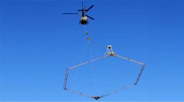
The Federal Ministry of Mines and Steel Development in collaboration with the World Bank had embarked on an Airborne Geophysical Survey activity to determine the accurate mineral deposits in Ekiti State.
The survey is being implemented through the Mineral Sector Support for Economic Diversification Project (MINDIVER), a World-Bank assisted programme.
Mr Akin Omole, the state Commissioner for Information and Values Orientation disclosed this in a statement on Saturday in Ado-Ekiti.
Omole revealed that the World Bank assisted project under the Federal Ministry of Mines and Steel Development, accounted for the presence of low flying airplane being sighted recently in some communities in the state.
According to him, the survey is expected to bring out more details and information on the geology and mineral potentials of the state.
“This is with a view to determining the mineral locations, types and their extent of availability,” he said.
Omole said the method of the airborne survey involved measuring minor variations in the earth’s magnetic fields and gamma radiations in the soils.
According to him, It is a passive technique that does not involve sending out any signals or sound waves into the ground and therefore remains a very safe aerial survey.
The commissioner said the presence of the low flying airplane in the project areas is safe and doesn’t portend any danger to the inhabitants.
“Members of the public are hereby urged to go about their daily activities without any fear as the airplane does not portend any safety or health hazard,” he said.
The News Agency of Nigeria (NAN) reports the airbone survey is to determine accurate mineral locations using modern contemporary aeromagnetic mechanism in 19 states across the country.
The states include: Kwara; Ekiti, Ondo, Osun, Oyo, Ogun and Ebonyi. Also Enugu, Cross River, Akwa Ibom, Kaduna, Niger, Kogi, Taraba, Benue, Plateau, Nasarawa, Bauchi and the Federal Capital Territory (FCT), Abuja.


Discussion about this post